This post describes the first testing of a mini-octagon calibration target for measuring water level with a camera and machine vision algorithms.
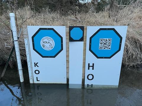
Mini-octagon (center) is approximately eight inches across, leading to a much smaller footprint for the target background. The other two octagons in the image are printed on plexiglass backgrounds two feet in width. Image credit: Mary Harner
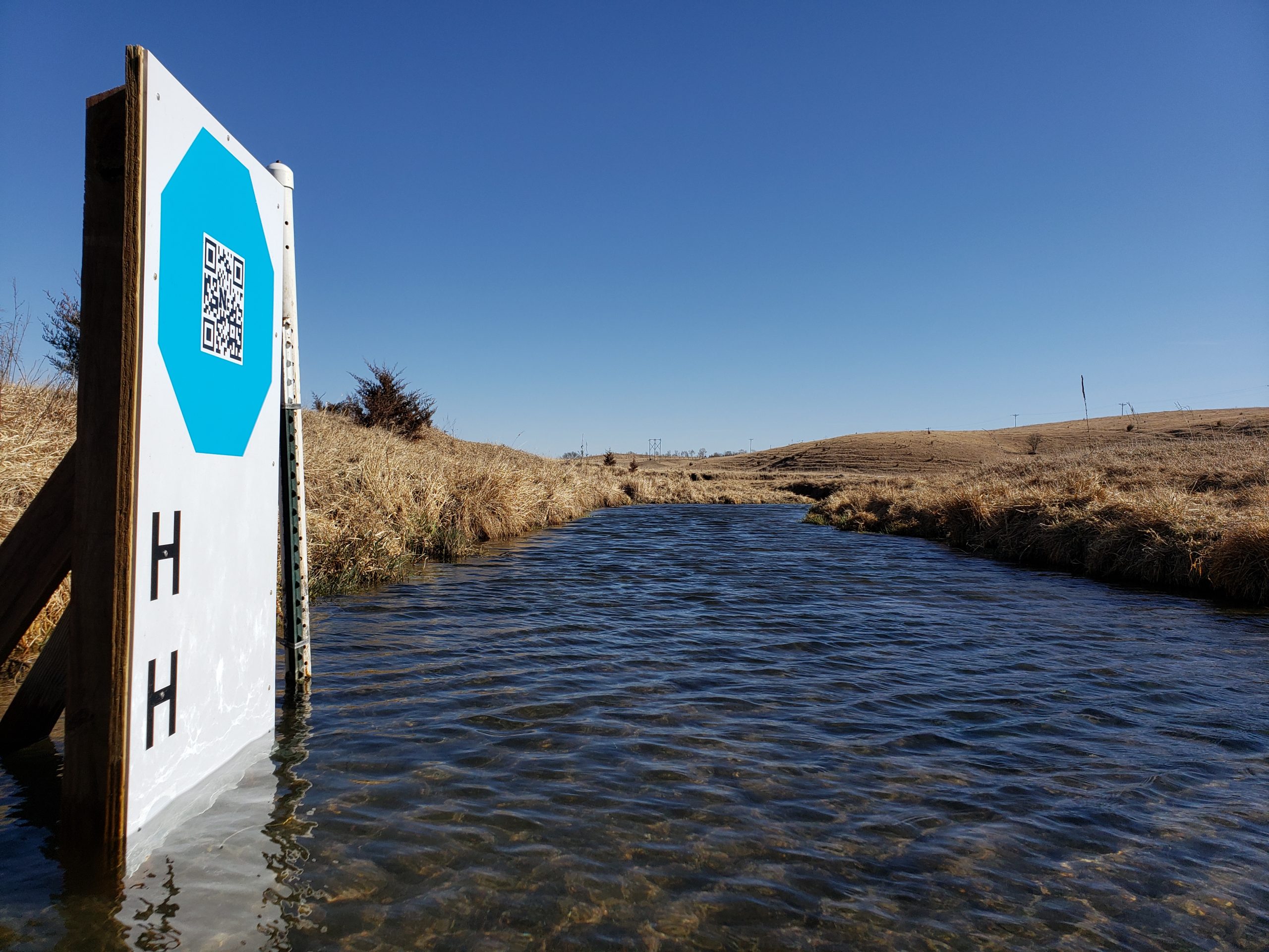
The original GaugeCam “bow-tie” calibration target was about three feet wide and four feet tall. This target yielded excellent calibration and precise water level readings. However, the size of the target is obtrusive in images and prohibitive at some sites.
The next generation calibration target, the “octagon target,” is approximately two feet wide. The benefits of the octagon are that (1) the target footprint is much smaller, and (2) the calibration target remains above the water line, so a calibration can be performed for every image. Calibrating each image is more robust because it accounts for camera movement, which is inevitable. The large octagon target performs on par with the original bow-tie calibration target, as shown in Ken Chapman’s dissertation.
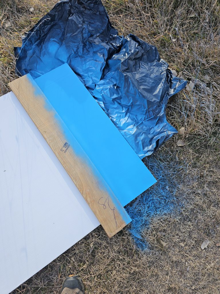
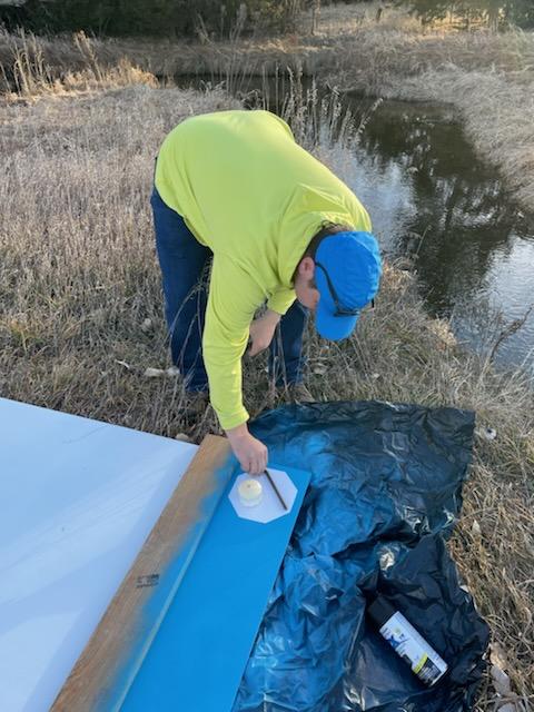
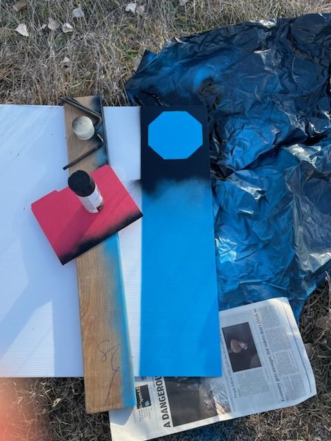
Our goal with the mini-octagon is to reduce the target background to the minimal size required for robust calibration and water level measurement. The current size is larger than a traditional staff gauge but reasonable size for installation in many environments. Below you can see our field fabrication of the first mini-octagon, using a sheet of Coroplast, spray paint, and octagon stencil.
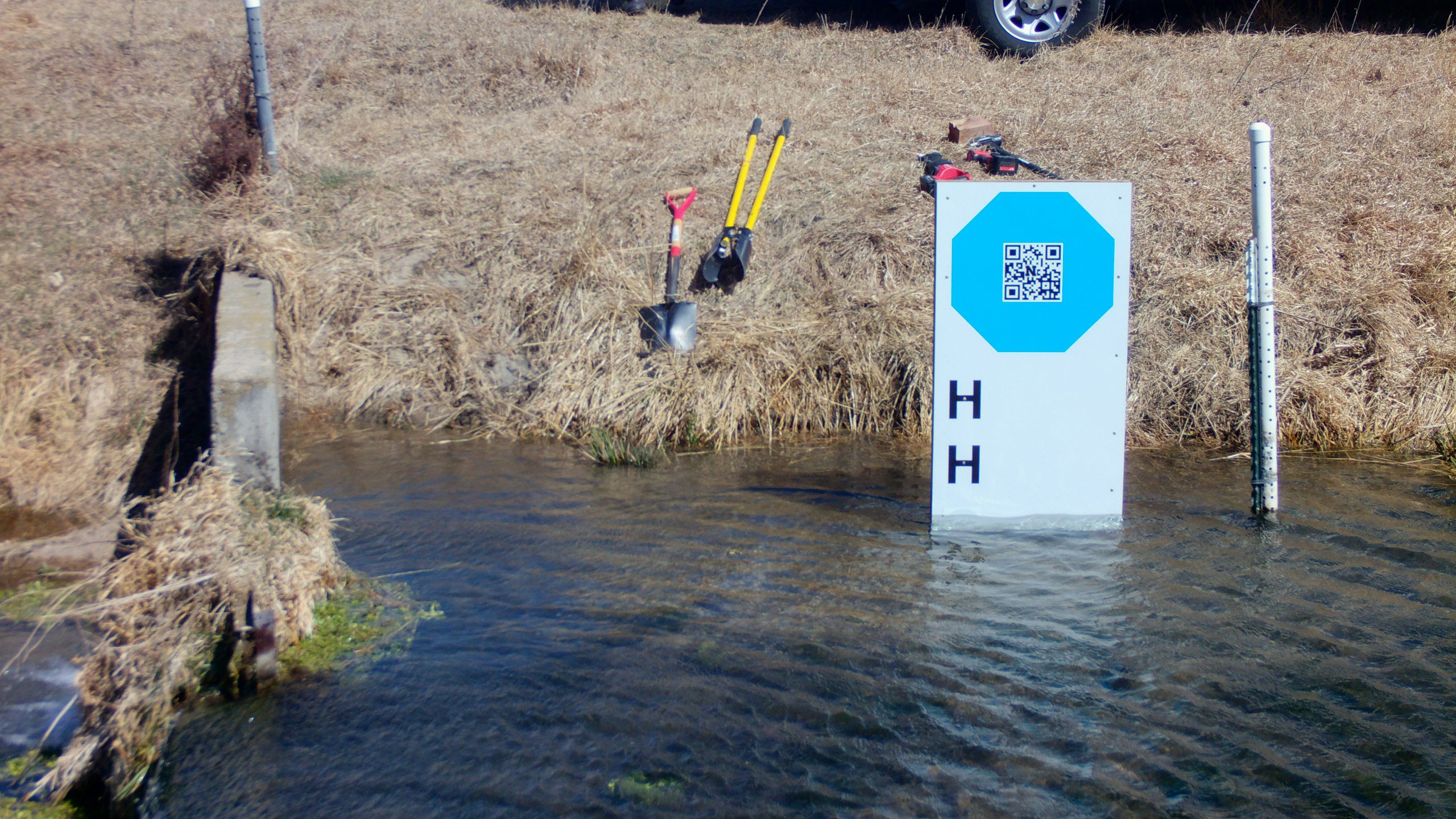
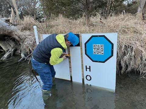
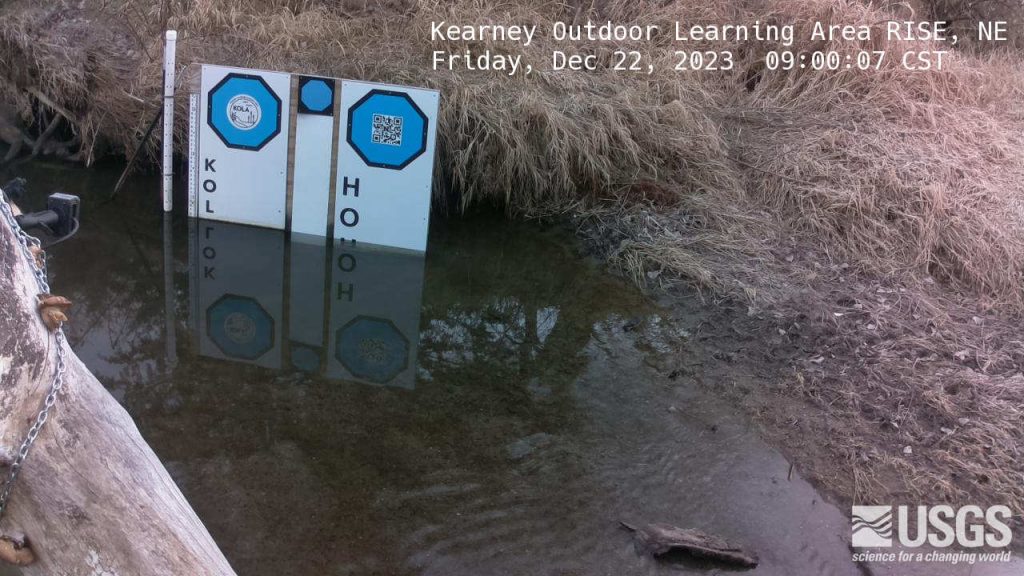
Test installation of the mini-octagon target at Kearney Outdoor Learning Area (KOLA). Photo Credit: Mary Harner
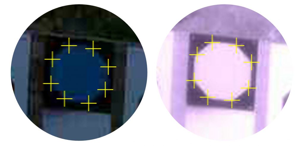
Initial tests show that our algorithms can detect the vertices of the mini-octagon in low-light conditions and under IR illumination.
Mini-octagon detection for image calibration. We are working to determine how much calibration precision is reduced by the smaller octagon.The latest KOLA imagery can be found at https://apps.usgs.gov/hivis/camera/NE_Kearney_Outdoor_Learning_Area_RISE.
In Spring 2023 the GaugeCam team at the University of Nebraska worked with two excellent student groups on their capstone projects in the Departamento de Computación and Escuela de Ingeniería y Ciencias at Tecnológico de Monterrey (ITESM).
The first group we are featuring is the KOLA Data Portal Team. These students did an amazing job creating a web interface for multimodal environmental data! Professor Elizabeth López Ramos was the instructor for this capstone course.
This project was focused on creating a data portal for the Kearney Outdoor Learning Area (KOLA) site that is located next to the Kearney, NE High School. The project was designed to simulate real interaction with clients and included two phases.
PHASE 1: Gather list of client requirements and develop proposal.
Requirement gathering and analysis based on meetings with client.
Research and brainstorm to devise innovative and practical solutions.
Create a concise proposal outlining solutions, timeline, budget, and benefits for the client.
Present refined proposal to the client, highlighting alignment with requirements and receiving feedback.
PHASE 2: Build out the data ingestion platform based on the accepted proposal.
Construct platform, including features and functionality described in the proposal.
Test platform functionality, performance, and security to meet client requirements and industry standards.
Present the platform to the client for feedback and iterate to meet expectations and requirements.
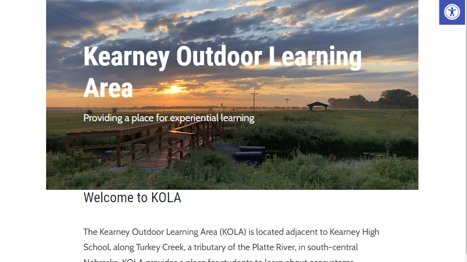
A view and description of KOLA can be seen in the screenshot below.
A view of KOLA courtesy of https://outdoorclassne.com.
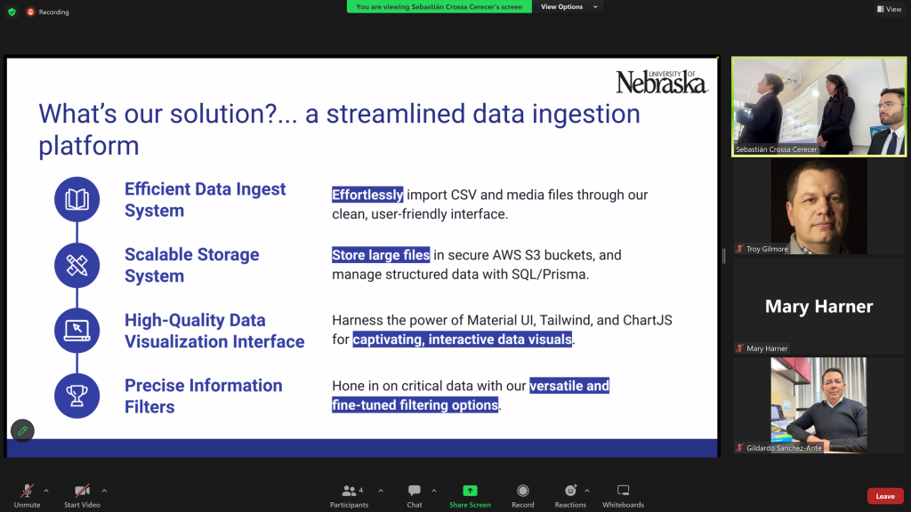
The key deliverables for the KOLA Portal project included the ability to upload and access several types of sensor data, including sound recordings, imagery, and scalar data (e.g., water levels). We met weekly with the KOLA Team. Students led those meetings, providing important updates and proposing next steps. As described in their final presentation, their solution consisted of the following:
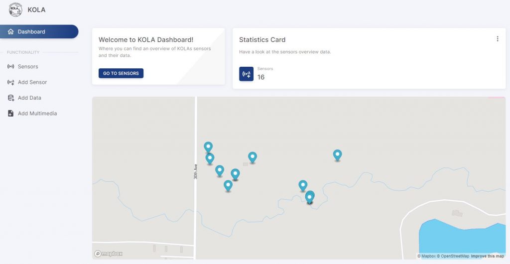
The KOLA Portal has an attractive welcome screen, including a site map showing the various sensors that provide environmental data.
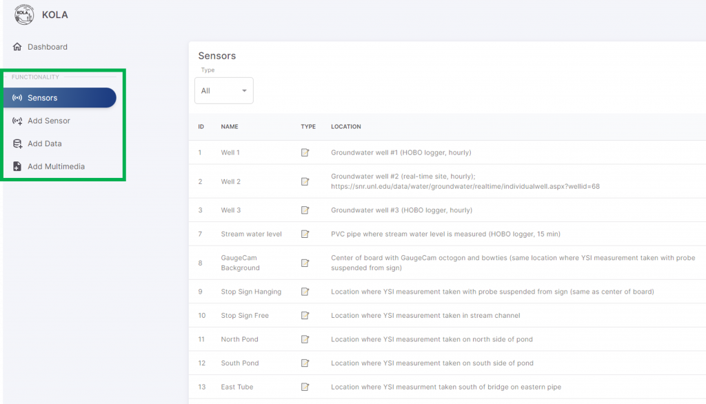
The green rectangle in the screenshot below highlights how we can now navigate from viewing the sensors, to adding a sensor, adding scalar data, and adding multimedia data on the platform.
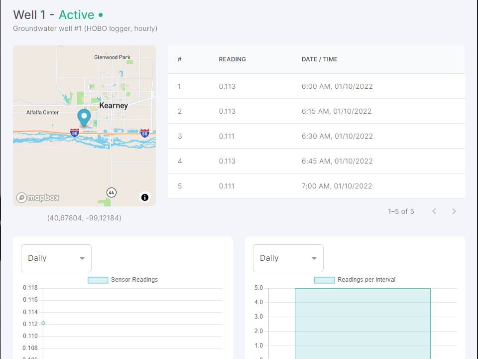
The portal also allows us to view sample data we provided the team, as shown below.
The KOLA Team also provided excellent documentation of the whole project! This was provided in a summary handoff email at the end of the semester. The video below shows the User Manual for the portal. The team also provided (1) an API reference and (2) a deployment guide that walks the user through the process of setting up the environment, navigating the codebase, and deploying the portal with the Next.js framework and Vercel hosting platform.
Overall, the KOLA Data Portal Team were highly productive and very professional. We are very grateful to Professor Elizabeth López Ramos and Professor Gildardo Sánchez Ante for involving us in the course. We learned a lot in the process and would love to work with other ITESM students in the future!