Water Level Camera: mini-octagon target test

This post describes the first testing of a mini-octagon calibration target for measuring water level with a camera and machine vision algorithms.

Image of three signs installed in a small stream. Each sign contains a blue octagon shape that is used to calibrate images for water level measurements.
Mini-octagon (center) is approximately eight inches across, leading to a much smaller footprint for the target background. The other two octagons in the image are printed on plexiglass backgrounds two feet in width. Image credit: Mary Harner

The original GaugeCam “bow-tie” calibration target was about three feet wide and four feet tall. This target yielded excellent calibration and precise water level readings. However, the size of the target is obtrusive in images and prohibitive at some sites.

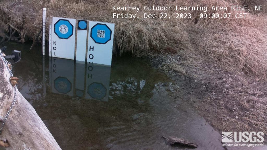
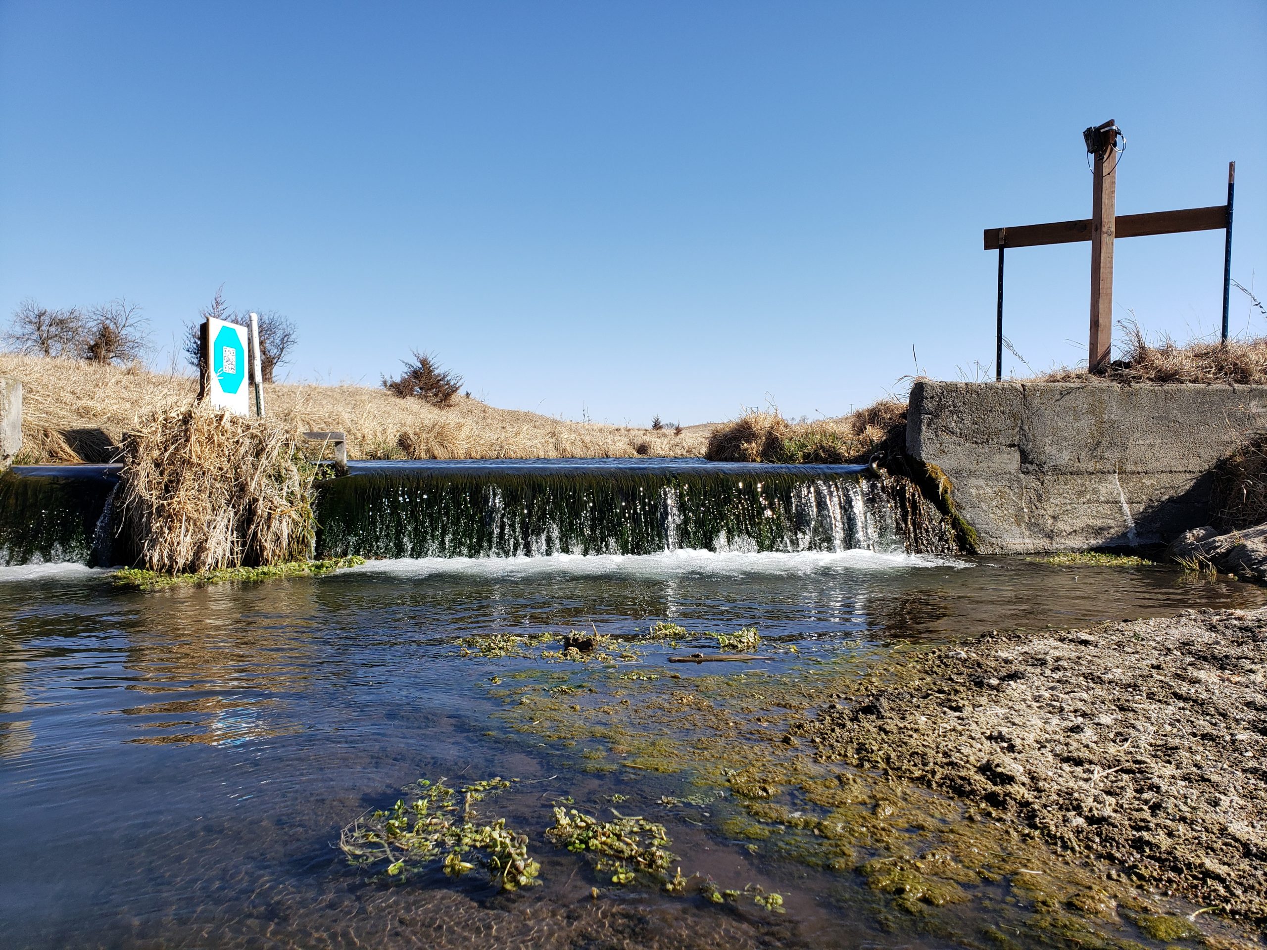
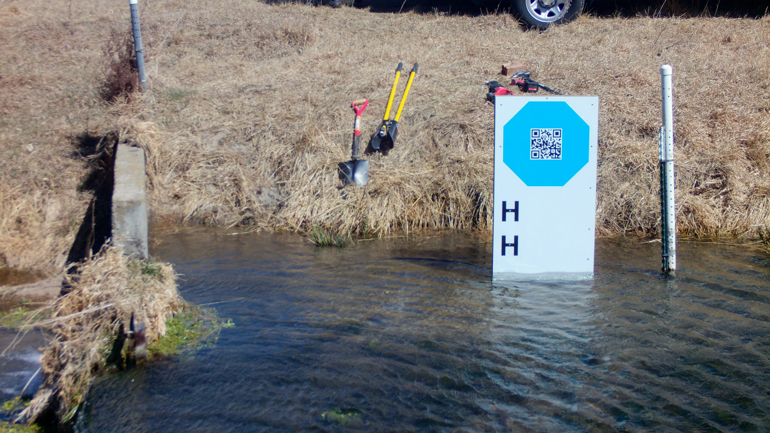
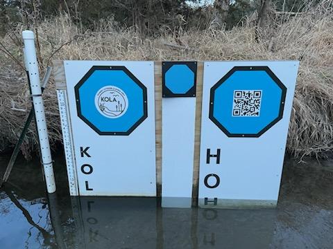
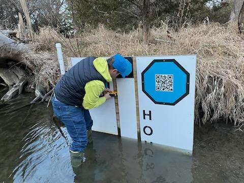
The next generation calibration target, the “octagon target,” is approximately two feet wide. The benefits of the octagon are that (1) the target footprint is much smaller, and (2) the calibration target remains above the water line, so a calibration can be performed for every image. Calibrating each image is more robust because it accounts for camera movement, which is inevitable. The large octagon target performs on par with the original bow-tie calibration target, as shown in Ken Chapman’s dissertation.

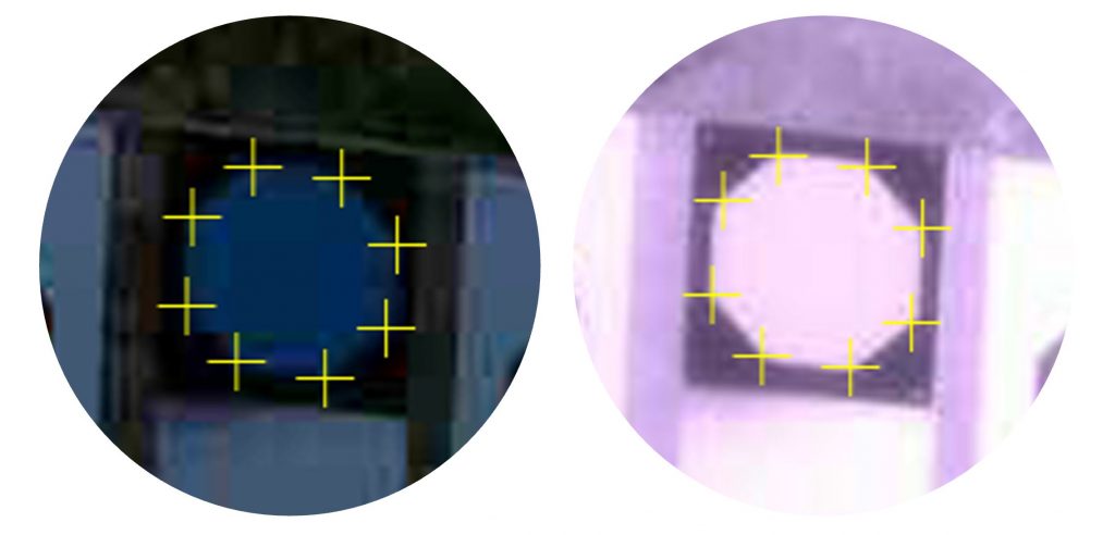
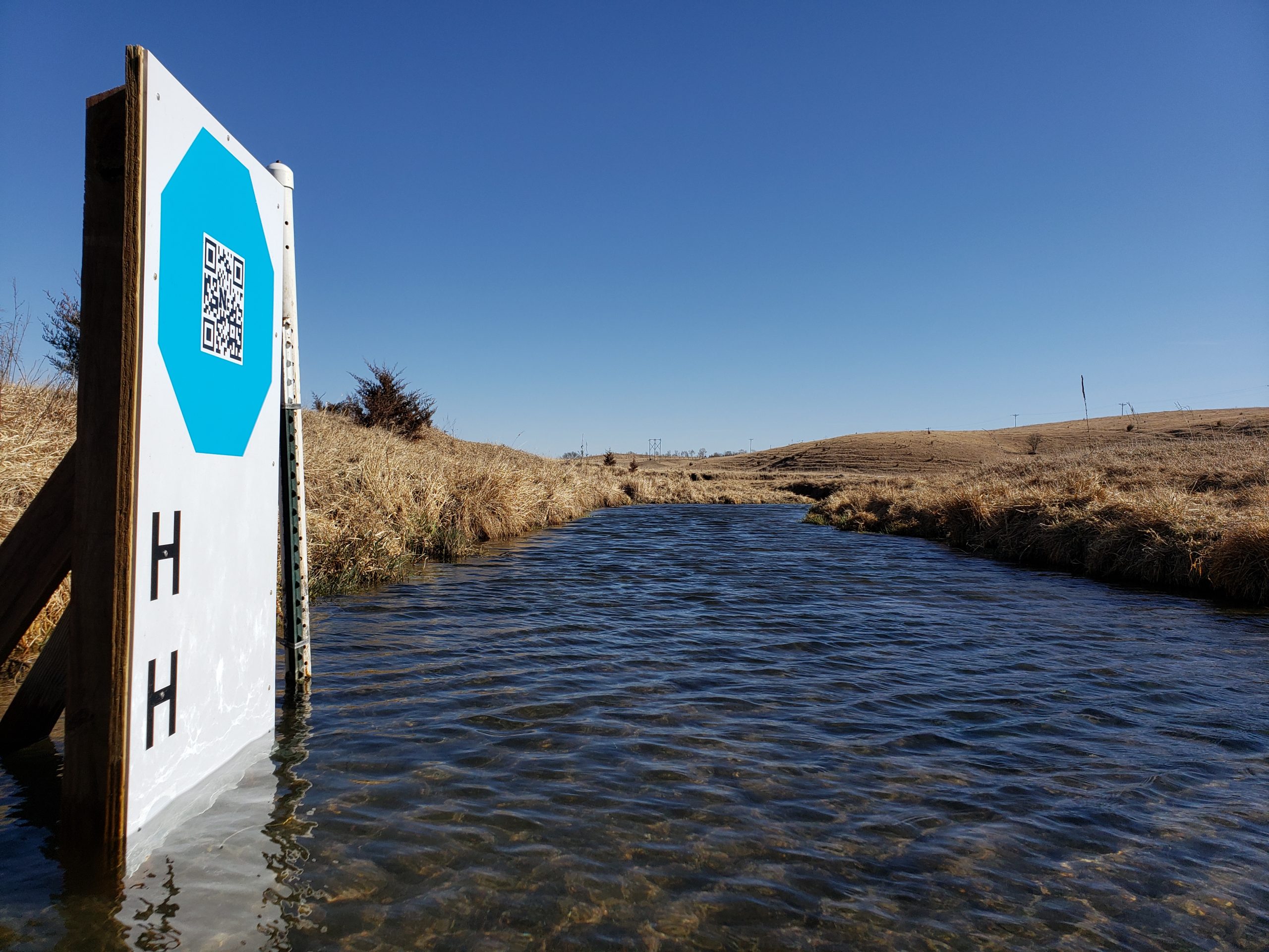
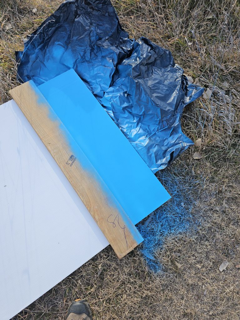
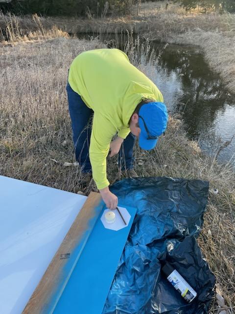
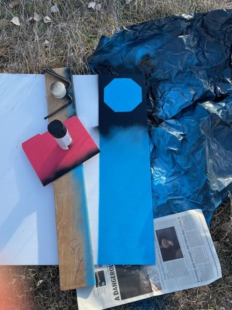
Our goal with the mini-octagon is to reduce the target background to the minimal size required for robust calibration and water level measurement. The current size is larger than a traditional staff gauge but reasonable size for installation in many environments. Below you can see our field fabrication of the first mini-octagon, using a sheet of Coroplast, spray paint, and octagon stencil.

Initial tests show that our algorithms can detect the vertices of the mini-octagon in low-light conditions and under IR illumination.

Mini-octagon detection for image calibration. We are working to determine how much calibration precision is reduced by the smaller octagon.
The latest KOLA imagery can be found at https://apps.usgs.gov/hivis/camera/NE_Kearney_Outdoor_Learning_Area_RISE.

December 2023 GRIME Software Fans Update

Featured Photo

Photo credit: Mary Harner and Troy Gilmore, using a Platte Basin Timelapse (PBT) style camera on the South Branch Middle Loup River near Whitman, NE.

Updates

  • Congratulations to GRIME Lab team member Ken Chapman, who defended his  dissertation and will graduate this month. Great job, Ken!
  • GRIME-related Proposals: two full proposals and a preproposal that involved GRIME software were submitted in November and December.
  • Check out the latest updates on our blog and let us know if/how we can support you project.

Software Information

What is GRIME?

GRIME (GaugeCam Remote Imagery Manager Educational) is open-source commercial-friendly software (Apache 2.0) that enables ecohydrological research using ground-based time-lapse imagery. The first GRIME software for measuring water level with cameras was developed in François Birgand’s lab at North Carolina State University.

What are GRIME2 and GRIME-AI?

GRIME2 and GRIME-AI are the two desktop applications developed by Ken Chapman and John Stranzl, respectively.

Who is involved in the GRIME Lab?

See the growing list at the bottom of our home page: https://gaugecam.org/

We collaborate closely with Mary Harner at University of Nebraska at Kearney: https://witnessingwatersheds.com/

ITESM Collaboration: Data Fusion Project

Building on the successful WaterFront Software and KOLA Data Portal projects, we embarked on another student-led adventure in the Fall 2023 semester! Professor Elizabeth López Ramos connected the GRIME Lab team with an excellent student team at Tecnológico de Monterrey (ITESM). These students led the Data Fusion Project.

The Data Fusion Project is a first step toward integrating data fusion features in the GRIME-AI user interface. And the ITESM team dived DEEP into the software development life cycle on this one! As “clients” the GRIME Lab team had multiple meetings and filled out an extensive questionnaire. This made us really think through the requirements we desired. The ITESM team extensively documented this process, which is a major benefit to everyone going forward. Below are some screenshots from the ITESM team’s final presentation.

Functional requirements defined through client interviews, questionnaires and prototyping.
Other requirements identified.
Screenshot of live demo during the final presentation. The GUI was built using tkinter. CSV files can be loaded, data merged based on timestamps and data can be visualized.

The ITESM did a great job of working across campuses and completing a lot of behind-the-scenes work required to finish this project. Their project can be found on GitHub.

Overall, we are grateful for the opportunity to work with the ITESM Team. They were very professional and worked hard to create a viable product!

Many thanks to:

  • Carlos Eduardo Pinilla López
  • Daniel Bakas Amuchástegui
  • José David Herrera Portillo
  • Juan Carlos Ortiz de Montellano Bochelen
  • Karla Paola Ruiz García
  • Romeo Alfonso Sánchez López
  • Víctor Manuel Gastélum Huitzil
Next steps identified by the ITESM team